HIKE 1: THE CHUNGBUK RIDGE LOOP – 17.9 km / 4.5 hours
Difficulty Rating: 3 - Intermediate I chose to do a loop this time around, starting at Beopjusa, climbing to Cheonhwangbong, continuing across the ridge to Munjangdae, and returning to Beopjusa from there (see map in previous post). It’s a nice easy, half-day hike overall. The 7.0 km from the temple to Cheonhwangbong is not particularly steep or rugged. In fact, the first 4.2 km is a gravel road rather than a hiking path, which winds alongside a placid lake. The last 2.8 km to the peak follows a well-maintained footpath with stone steps. Views of the valley are scattered here and there once you break from the trees. Unfortunately, it rained for the first 2 hours of my hike, so I could see very little below me. It took me about 90 minutes to reach Cheonhwangbong at a steady pace.
From there it took another hour to do the 4 km along the ridge to Munjangdae. The ridge section, which is studded with interesting rock formations like Ipseokdae and Gyeongeopdae, has little in the way of elevation change, so you can move at quite a rapid pace.
Once at Munjangdae, the weather cleared a little and I was able to look north over an impressive collection of small mountains nestled in the clouds. Munjangdae is famous, because King Sejo supposedly recited a poem at the spot. Now a set of steel steps leads up the side of the rock to the top. The top of the rock is fairly small and can become crowded quickly. If I do this hike again, I’ll get there earlier in the morning before most of the pack gets going. There’s a small store just below Munjangdae that sells water and snacks and blares the Korean national anthem at an obnoxious volume from time to time (luckily you can’t hear it at the top).
Ideally, if you had more time than I did, you could continue west for 11.2 km and eventually end up at the end of the Chungbuk Alps in Shinjeong-ri. Getting an early start, it would be possible to do the entire thing in one day and head home from Shinjeong-ri.
The 7.1 km trek from Munjangdae back down to Beopjusa takes about 90 minutes, passing through lush forest areas and by small waterfalls. The entire route has good signage, both in Korean and English.
HIKE 2: BEOPJUSA-MUNJANGDAE LOOP - 15.5 km / 3.5 hours
Difficulty Rating: 3 - Intermediate
The route begins at Beopjusa, ascends to Munjangdae, via the (A) Trail, and returns to Beopjusa, via the (B) Trail.
HIKE 3: BEOPJUSA-MUNJANGDAE ALTERNATE LOOP - 17 km / 4.5 hours
Difficulty Rating: 3 - Intermediate
The route begins at Beopjusa, ascends to Munjangdae, via the (B) Trail, continues to Shinseondae, and then descends to Beopjusa, via the (C) Trail.
HIKE 4: BEOPJUSA-MUNJANGDAE-CHEONHWANGBONG LOOP - 19 km / 4.5 hours
Difficulty Rating: 4 - Strenuous
The route begins at Beopjusa, ascends to Munjangdae, via the (B) Trail, crosses the ridge to Cheonhwangbong, and returns to Beopjusa, via the (D) Trail.
HIKE 5: BEOPJUSA TO SHINJEONG VILLAGE - 29 km / 7-7.5 hours
Difficulty Rating: 5 - Very Strenuous
The route begins at Beopjusa, ascends to Cheonhwangbong, crosses the entire ridge (past Munjangdae, Gwaneumbong, and Myobong), and finishes at Shinjeong Village.
RECOMMENDATIONS
Start early. The earlier, the better. Small national parks like this one are flooded with pushy, noisy local day-hikers from about 10 AM on-ward. If you want to enjoy nature with relative peace and quiet, time it so you can be on your way down by the time the crowd arrives.
(Contributed by Alex)
SONGNISAN (속리산) Hiking Routes

SONGNISAN (속리산) National Park: The Basics
CLICK here for high resolution printable trail map (1.16 MB).
Songnisan* became a national park in 1970. It’s the 6th largest of Korea’s mountain parks with an area of 275 km2. The name means “Remote from the Ordinary World”—a reference to its somewhat isolated position in the center of South Korea. The mountains belong to the southern arm of the greater Sobaek Range, and the park lies on the border between North Chungcheong and North Gyeongsong Provinces.
In 1999, someone decided to cash in on the name of a famous set of mountains in Europe by dubbing the ridge that connects Gubyeongsan, Songnisan, Gwaneumbong and Sanhakbong the Chungbuk Alps. The name is a little misleading, as the highest mountain here is only a humble 1,058 meters. On the English brochure available at the tourist center in the Songni-dong Bus Terminal building, it states: “A hiking path was opened and transformed into a commercial product.” This perhaps says something about how Koreans view their mountains and is a hint that hiking here might not always be peaceful and relaxing. The park gets about 1.5 million visitors a year.
*Don't be confused by the spelling. The Korean letters spell out "Sokrisan" but the name is actually pronounced "Songnisan."
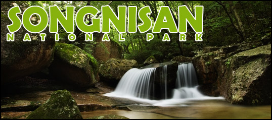
Songnisan is very scenic. On wet days clouds often catch in the valleys between the mountains, creating a dramatic layered effect. In the spring, the area is known for the brilliant pink azaleas that bloom on the mountainsides. The mountains have a craggy look, with lots of interesting granite out-croppings and cliffs.
The park is great for beginning hikers with lots of nice easy-to-moderate day hikes. The mountain range is shaped like the back of an ampitheater, with the ridge curving around the valley from south to west. Along this boney semi-circle are 8 small peaks. Starting in the south and going northwest they are: Peak 1 (721 m), Hyeongjebong (803 m), Cheonhwangbong (1,058 m), Birobong (1,032 m), Munsubong (1,031 m), Gwaneumbong (985 m), Myobong (874 m), and Sanhakbong (861 m).
GETTING THERE
Take an express bus from Busan Nopo-dong Bus Terminal to Daejeon Dongbu Express Bus Terminal. Cross the street to Daejeon Intercity Bus Terminal and take a local bus to Songnisan National Park.
BUSAN Nopo-dong Terminal ► DAEJEON Express Bus Terminal
Fare: W20,000 / (W13,600)
Duration: 3 hours
07:30 09:00 12:00 14:00 (15:30) 17:30 19:00
To get to Daejeon Intercity Terminal from Daejeon Dongbu Express Bus Terminal, exit the building, turn left, cross the street and turn left again. Follow the sidewalk for about 5 minutes.
DAEJEON Intercity Terminal ► SONGNISAN NAT’L PARK Bus Terminal
Fare: W6,300
Duration: 90 minutes
07:00 ◄ Every 40-60 minutes ► 19:00
Get off the bus at Songni-dong tourist village at the entrance to the park.
GETTING AWAY
SONGNISAN NAT'L PARK Bus Terminal ► DAEJEON Intercity Terminal
Fare: W6,300
Duration: 90 minutes
07:00 07:28 08:10 09:05 10:15 11:20 12:10 12:55 13:50 14:30 15:20 16:20 17:20 17:40 18:30 19:10 20:00
DAEJEON East Express Bus Terminal ► BUSAN Nopo-dong Terminal
Fare: W20,000
Duration: 3 hours
07:30 ◄ Every 30-50 minutes ► 19:00
SLEEPING & EATING
Songni-dong, like most national park villages in Korea, is packed with hotels, yeogwon (inns), and minbak (guesthouses). You can find something without difficulty by wandering for a few minutes among the sidestreets. Clean, comfortable single rooms with a private bathroom, TV, and yeo (Korean floor mattress) are easy to find for W20,000/night. If you’re in a group, you can get a shared room and save even more money. The main street is lined with scores of restaurants that don’t seem to deviate much from a set menu of soups, barbeque, and bibimbap. There are dozens of bars. The area around the hotels and minbak is full of noraebang (singing rooms). For the tiny size of the village, it sure seems to be an active place a night, with plenty of drunks staggering around or passed out in the middle of the road (I witnessed both). There are also plenty of small mini-marts, but the range of products is limited. Bring your own snacks and trail food with you.
There’s a fake waterfall off the main street that is lit-up at night and attracts lots of attention. There’s also a nice grassy park, filled with modern art sculptures (the first time I visited Songnisan I spent the night under a bush in this park). That's about the extent of the little "town."
CAMPGROUNDS
A large campground can be found to the east of the village, but it’s only open in July and August. The whole campground thing is quite undeveloped in Korea, and it has been explained to me that this is because the average Korean finds camping too inconvenient and uncomfortable.
BEOPJUSA
Beopju Temple, at the entrance to the park, is one of the largest Buddhist complexes in Korea. It dates back to 553 A.D., but like most historical structures in Korea, the actual buildings were burned to the ground by the Japanese during the 1592 invasion. It was rebuilt in 1624. The highlights of this temple are the Daungbojeon prayer hall with three huge golden Buddhas; the 5-floor Palsangjeon, largest of the wooden pagodas in Korea; and the 33-meter bronze Buddha statue. Even though the latter was only constructed in 1990, it is impressive for its sheer size. There’s also a large Buddha image carved into a massive boulder on the grounds.
TRAIL CLOSURES
There are no trail closures in this park.
VIEW OTHER TRAIL CLOSURES ON THE KNPS WEBSITE
CONTACTS
[Park Office] : 19-1 Sangpan-ri Naesongni-myeon Boeun Chungbuk
[Tel] : 82-43-542-5267
OFFICIAL KNPS SONGNISAN WEBSITE (English)
(Contributed by Alex)
JIRISAN (지리산) Hiking Routes
HIKE 1: SSANGGYESA TO CHEONGHAKDONG - 5-6 hours
Difficulty Rating: 4 - Strenuous
This route starts at Ssanggyesa (temple), winds up past Buril Falls 폭포, and ascends to the Samshin Peaks. From there it's either down to Cheonghakdong or back the way you came.
It's a steep trail in places and a dry one (there aren't any springs in this vicinity beyond the temple), but one of the positives is that it seems to be less frequented than some of the other trails. From the temple, the trail leads 2.3 km up to Buril Falls, which can be impressive after heavy rains and underwhelming at other times. Beyond the falls, the hike has nice coverage, snaking through shaded forest areas and along a small stream. About two thirds of the way up, the tree cover opens up and nice views of the valley can be seen. It's possible to reach Samshinbong, the furthest but not the highest of the two peaks, in 3 1/2 to 4 hours (6.9 km from the Buril Falls junction). The hike down to Cheonghakdong takes about 1 to 1.5 hours, while a return hike back to Ssanggyesa can be completed in 2.5 hours.
(Contributed by Alex)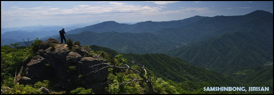
HIKE 2: EAST RIDGE HIKE (Daewonsa to Georim) - 27 km / 9-11 hours
Difficulty Rating: 5 - Very Strenuous
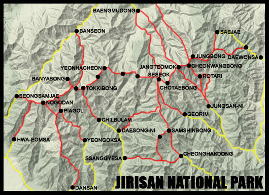
This monster hike begins at Yupyeong Village (just beyond Daewonsa), ascends to Chibanmok Shelter, crosses the ridge--including Sseoribong (1,642 m), Jungbong (1,875 m), Cheonwangbong (1,915 m), Jeseokbong (1,806 m), Chotaebong (1,704 m), and Yeongshinbong (1,652 m)--and descends from Seseok to the Georim Valley exit.
The hike from Yupyeong Village to Chibanmok Shelter is steep and rocky for the first 2 km or so. Then it levels off for awhile, passing through amazingly lush forest and above a deep river valley. There are gentle ups and downs and some nice views when the clouds lift. The trail is rough, but well-marked most of the time (look for pink ribbons in the trees or periodic cell service markers if you aren't sure). During or after heavy rain, temporary streams form that cross the path or completely replace it (I was here once during a typhoon). The rivers can become swollen and dangerous, in which case it's best to avoid them. The last 2 km again regain a steep incline and include a series of metal steps. The park service estimates hike time to Chibanmok at 3.5 hours, but I was able to do this stretch in 2 hours and 10 minutes at a brisk pace. This ascent is less difficult than the Hwaeomsa trail on the other end of the range.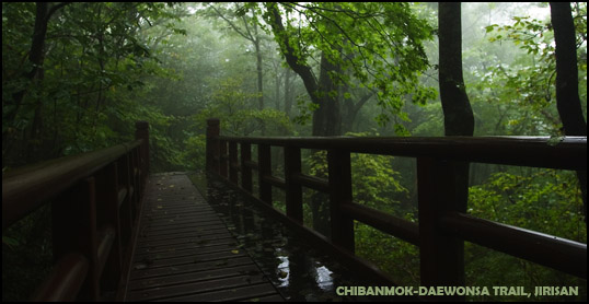
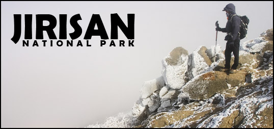
From Chibanmok to Jungbong, the path goes up and down quite a lot, but there’s nothing terribly steep. There are tiny granite markers at Sseoribong and Jungbong, but not much else to let you know you reached a point of signficance. Cheonwangbong--the highest peak in Jirisan and 2nd highest in Korea--is only another 0.9 km beyond Jungbong (3rd highest). The 4 km from Chibanmok to Cheonwangbong can be accomplished in under 2 hours in good weather. Note that much of the ridge is exposed to brutal northerlies. Even in late September, it was nippy. Two months later, the trails were icy and dangerous, there was a dusting of snow on the ground and trees, and strong freezing winds blasted us from the north whenever we came out into an open place. Appropriate windproof clothing is suggested. A complete white-out is not uncommon on the ridge. Out of three recent trips, there was clear weather on only one, where we got great views from the top of Cheonwangbong. I'm told you're very, very lucky if you get any good views from the top at any time of year. At Cheonwangbong, a 9.7 km trail leads off north through Chilseon Valley to Chuseong Village, but a large portion of this trail is currently off-limits for nature restoration.
From Cheonwangbong, it took only 30 minutes to cross the relatively easy 3.4 km to Jangteomok Shelter (about 1 hour going the other way). There’s quite a lot of downhill along this section going west. Jangteomok is a large, ample shelter that requires reservations, except in cases of emergency. From the shelter, trails go north to Baengmudong Village and south to the Rotari Shelter and Jungsan-ni Village.
From Jangteomok going west, it's more of the same with some ups and downs and fairly good trails for a distance of 3.4 km. It took me about 1 hour and 10 minutes to reach the third and largest of Jirisan’s shelters, Seseok.
Seseok Shelter is at the junction of several trails. Going west, follows the ridge route 6.3 km to Byeoksoryeong Shelter and eventually to the end of the range at Hwa-eomsa (Temple). Going north takes you 6.5 km to Baengmudong Village. Going south, you can exit the park through Daeseong-ni (9.1 km), Cheonghakdong, or Ssanggyesa (19 km). The latter two trails are very long, following the southern arm of the mountain away from the ridge. Another trail leads southeast 6 km to Georim Village. The Georim trail is extremely steep, rocky, and brutal. There are large sections of jumbled rocks and boulders that hikers must pick their way through. Coming down was hell after already doing 21 km, and I can imagine heading up this trail is pure torture.
The park service estimates this hike at 11.5 hours. I did it in late summer in 9 hours, but without any breaks longer than 10-15 minutes. I packed light and moved quickly--a slower pace would be safer, especially on the downhill sections. The same section of the ridge was hiked in much colder weather going the other direction and it took a couple of hours longer.
(Contributed by Alex)
HIKE 3: WEST RIDGE HIKE (Hwa-eomsa to Byeoksoryeong Shelter) - 10 hours
Difficulty Rating: 5 - Very Strenuous
This route starts at Hwa-eomsa (temple) and ascends steeply to the main ridge near Nogodon Shelter. From there, the trail follows the mountains east.
Hwaeomsa Service Complex is a good 30-minute walk (about 1.5 to 2 km) from the temple up the road. The trailhead is to the right when facing the temple entrance. It starts out with a short walk through a grove of trees and then quickly begins to climb. From that point on expect a steep 7 km slog to the top. This particular approach seemed brutally steep and endless in contrast to the climb from the east, starting at Daewonsa. But maybe I was just carrying more weight. It took us about 2.5 hours to get to the Nogodon Shelter area. Don't be disconcerted by the crowds around Nogodon--many people just do the easy walk from Seongsamjae and then turn around. Everything thins out as you move east.
The 3.2 km from Nogodan to Imgeolryeong (ridge) was characterized by ups and downs, but nothing terribly difficult. At Imgeolryeong, a trail leads south 6 km past Piagol Shelter and out of the park at Jikjeon. Another 1.3 km beyond that, we came to the turn-off for Banyabong. According to the KNPS website, Banyabong is closed to hikers. But not seeing any signs on the trail, we decided to try. We opted to dump our packs for the short 2 km hike to the peak (about 45 minutes round-trip), which turned out to be a great idea. Banyabong is famous for its views, especially around sunset, but we encountered heavy fog and could see nothing below. The peak is marked with a small, inconspicuous granite pillar. There were no signs to indicate that the area was restricted and we saw quite a few other hikers there.
After Banyabong, we moved on to Baemsagol Shelter, which we were surprised to find was closed. People were still using the area for cooking and the drinking water was flowing, but nobody seemed to know why the shelter was closed and if it would be open again in the future. It's located at the bottom of a long series of stairs. From Baemsagol, a trail leads north 9 km to Banseon Service Complex in Namwon County. Not far beyond this, another trail leads south through the Moktong Valley to Chilbuam and eventually the Hadong park exit.
We hurried on past the rather insignificant Tokkibong and Myeongseonbong, stopped briefly to stock up on water at Yeonhacheon Shelter, and finally made it to Byeonksoryeong Shelter by late afternoon (about 7.2 km from Tokkibong). The last little bit before the shelter is quite rough and rocky.
(Contributed by Alex)
HIKE 4: HWA-EOMSA TO DAEWONSA (the entire ridge)- 45 km / 19 hours
Difficulty Rating: 5 - Very Strenuous
Take two monster day hikes and put them together and you have...well, pain. But also a lot of fun! We just completed this hike in mid-November over a period of two days (10 hours from Hwa-eomsa to Byeoksoryeong Shelter and 9 hours from Byeoksoryeong to Daewonsa). It's more typical for people to cross the ridge in three or four days, but a weekend sprint is definately possible from May through November. The rest of the year it's too cold and icy to risk moving that quickly.
We started with a 30-minute walk up the road from Hwa-eomsa to the service complex early in the morning. The trailhead is to the right of the temple entrance. The 7 km to the ridge was the steepest and most challenging part of the whole experience for us, maybe because we weren't warmed up. We got to Nogodon in 2.5 hours, but it was painful.
The next 4.5 km to the Banyabong turn-off was relatively easy, with alternating ups and downs. At this point we stashed our packs in the forest and did a quick sidetrip to Banyabong, which took 45 minutes round-trip. After returning to the main ridge trail, we moved on past Baemsagol Shelter (down stairs north of the trail), Tokkibong, and Myeongseonbong.
We took a short water break at Yeonhacheon Shelter and moved on to Byeonksoryeong Shelter in the late afternoon. The last hour was a bit rough. We were feeling pretty worn out and the trail seemed unusually rocky and uneven. In all, the hike from Hwa-eomsa to Byeonksoryeong took us 10 hours. We stopped there for the night. We didn't have reservations, but they grudgingly put us up anyway. The night was very long and very hot with lots of people snoring loudly all around us. There are no pads or mats on the sleeping platforms, which makes for a sleepless night if you not have your own padding.
In the morning we got up early and were on the trail by 4:30 AM. It took us about 90 minutes to do the 6 km to Seseok, where we took a bathroom break, before sprinting on to Jangteomok. Strong, cold winds were blowing a light snow on the northern side of the ridge. When the trail snaked over to that side we had to bundle up, but the south side was quite comfortable and without wind. The section from Seseok to Jangteomok seemed to be gradually uphill the whole way, so this part took us as long as the former portion even though the distance was much shorter. We reached Jangteomok about 7:45, took a breather, and struggled toward Cheonwang Peak. We got to the summit about 8:30 and spent about a half hour there. Again, the north side of the summit was cold and blustery with a thin layer of ice and snow, while the south side was mild and dry.
Once beyond Cheonwangbong, the trail was more or less downhill, which was less of a cardio workout but really hammered at the knees and ankles. We only took a couple of 5 minute breaks between there and Daewonsa, reaching the end around 1:30 PM--a total of 9 hours. The last section from Chibanmok to Daewonsa was pretty brutal downhill stuff, especially on tired legs. We both would have preferred a little more climbing to the high impact slamming you get from moving downward.
(Contributed by Alex)
HIKE 5: Jungsan-ni Village → Cheonwangbong - 5.7 km / 3-5 hours up
Difficulty Rating: 4 - Strenuous
This hike begins at Jungsan-ni Tourist Village, passes Kalbawi, and continues steeply for 4 km to Jangteomok Shelter. From there it's another 1.7 km eastward along the ridge to Cheonwang Peak.
We set out on the trail around 1 PM, which we discovered was much too late to be starting a hike like this. We were in reasonable shape but not athletic really. It took those of us in our 20s and 30s about 5.5 hours to reach the summit, while those in their 40s took about 6.5 hours. The sun went down about thirty minutes before we got to the top (a good reason to start earlier). Hiking in the dark was not especially fun. The one person in our group who had done the hike before made it up to the top in 3 hours. The trail is quite steep--it's like climbing stairs for the whole way. I'd recommend leaving in the morning to better enjoy this hike, rather than trying to race the sun. Note that we did this hike in April, and there was still some snow and ice near the summit. The air was very cold. Some warm clothes are advised.
(Contributed by Kathleen)
HIKE 10: Daesong-ni → Seseok Shelter - 9.1 km
Difficulty Rating: 4 - Strenuous
I recently hiked from Daeseong-ni to Cheonwangbong and back the way I came. The hike was beautiful and we were on the trail for 6 hours without seeing another person. However, unlike the main ridge, the Daeseong-ni trail has no place to refill your waterbottles. There is a little village about an hour from the start of the hike. Be aware that this the last place to get water before you get to Seseok Shelter. Make sure you pack enough H20.
(Contributed by Val)
RECOMMENDATIONS
There are plenty of potable springs 분수대 along the ridge for refilling water bottles, so it's not necessary to carry large amounts of water. You should plan to drink 4-5 liters during a full-day hike (more in hot weather).
The shelters 대피소 don't sell enough food to make a full meal. They have things like ramen, canned meat, pre-cooked rice, canned coffee, cookies, and crackers. There's also no way to cook anything unless you bring your own stove. Packing in plenty of food is important (3,000-4,000 calories a day during the warmer seasons / 4,000-5,000 calories for winter). About 75% of your calories should come from carbohydrates.
Camping on the mountain is illegal, but possible in extreme emergency situations. I've encountered Koreans tenting it in various places on the ridge. In such a case, you'd need a tarp or tent to keep you dry and a good sleeping bag to stay warm.
Baemsagol Shelter was closed to overnight hikers, as of November 2007, though you could still cook outside the shelter structure and get water at the spring.
The use of gas backpacking stoves is limited to the shelter grounds and illegal in all other areas.
Pack out ALL your trash, rather than make it a burden for the shelter caretakers.
(Contributed by Alex)
WESTERN JIRISAN (지리산) National Park: The Basics
CLICK here for high resolution printable trail map (1.27 MB).
The western half of Jirisan National Park, which lies mostly in Gurye and Namwon Counties, is lower in elevation than the eastern half and less rugged, but no less beautiful. The major peaks along the western ridge include: Nogodan (1,507 m), Banyabong (1,733 m), Tokkibong (1,534 m), Myeongseonbong (1,586 m), and Samgakbong (1,462 m).
Nogodan and Banyabong are the big local attractions on the ridge, while the Piagol Valley hike is extremely popular in autumn.
ENTRANCES TO THE PARK
The western half of Jirisan National Park currently has five entry points:
(1) Hwa-eomsa (temple) in the southwest
(2) Seongsamjae Village in the northwest
(3) Jikjeon / Yeongoksa (temple)in the south
(4) Moktong / Chilbuam in the south
(5) Banseon Village in the north
SLEEPING & EATING
The same is true of the west as of the east--there are plenty of lodgings and places to eat at most of the major entry points, including Hwa-eomsa Service Complex, Seongsamjae Village, Yeongoksa Service Complex, and Banseon Service Complex. Expect to pay between W20,000 and W30,000 for a single room and W6,000-8,000 for a decent meal. Gurye has shops near the bus terminal with basic hiking equipment, stoves, maps, gas, and some food items.
CAMPGROUNDS
Campgrounds are located at four locations in Western Jirisan:
(1) Near Hwa-eomsa Service Complex
(2) Near Banseon Service Complex
(3) In the Hwajom Valley
(4) In the Waun Valley
Campgrounds cost W3,000-7,000 per night. Facilities vary. Call the park office to make reservations.
MOUNTAIN SHELTERS (대피소 Daepiso)
Going east from Hwa-eomsa, there are four mountain shelters (3 on the ridge):
(1) Nogodan Shelter
(2) Piagol
(3) Baemsagol Shelter
(4) Yeonhacheon Shelter
With the exception of Nogodan, the western shelters are quite small and simple. When we were there in mid-November, Baemsagol Shelter was closed to hikers and there was no information about when it would be re-opened. With the exception of Piagol and Baemsagol, the rest of the shelters require reservations. Bring your own food, cook stove, and sleeping pad. Blankets can be rented for overnight use.
Simply click on the link below and follow the directions on the page to make reservations at any of the shelters at Jirisan. The park service will confirm your reservation by email within 1-2 days. Reservations can be made 2 weeks in advance.
MAKE SHELTER RESERVATIONS HERE
NOGODAN DAEPISO
W7,000 pp (June, September, December-March) / W8,000 (all other months)
The largest of the western shelters, Nogodan accommodates about 100 people. This shelter is located not far from civilization (Seongsamjae Village), so expect plenty of company. Make your reservations early.
PIAGOL DAEPISO
W5,000 pp
This small shelter is about 2 kilometers down the Piagol Valley trail from the ridge and does not require reservations. At peak times of the year, you'd have to get there early to get a spot to sleep. This shelter was deserted and appeared to be not operational in August 2008. Call before you start your trip.
BAEMSAGOL DAEPISO
W5,000 pp
Baemsagol is another small, simple shelter, located at the bottom of a long series of steep stairs, leading north from the ridge. As mentioned above, it was closed when we passed by in mid-November 2008. Call the park service before making any plans to stay there. Even when closed, you can cook in the area around the shelter and there's a freshwater spring right outside the building.
YEONHACHEON DAEPISO
W5,000 pp
Yeonhacheon accommodates about 35 people. There's a freshwater spring not far from the building.
TRAIL CLOSURES
Despite what it says on the KNPS website, both Nogodan and Banyabong peaks were open to hikers as of November 10, 2007. There are no other closures that I know of that would affect people on the western trails.
GETTING THERE
From Busan, buses depart for Gurye and the Hwa-eomsa entrance:
BUSAN Seobu Sasang Terminal ► GURYE Bus Terminal / HWAEOMSA Temple
Fare: W12,200
07:00 08:00 10:00 11:00 12:00 14:00 15:00 17:00 18:00
Duration: 3 hours / 3 hours 20 minutes
For the Seongsamjae entrance, take a bus from Gurye. Buses are marked with the final destination "Nogodon," but you still have a short walk up to the peak from the village where they stop:
GURYE Bus Terminal ► SEONGSAMJAE Village
04:00 06:00 08:20 10:20 11:40 13:40 15:40 17:40
VIEW OTHER TRAIL CLOSURES ON THE KNPS WEBSITE
CONTACTS
[Park Office] : 922-18 Sari Sicheon-myeon Sancheong Gyeongnam 666-934
[Tel] : 82-55-972-7771
OFFICIAL KNPS JIRISAN WEBSITE (English)
JIRISAN (지리산) - South Entrances (Ssanggyesa / Daeseong-ni / Cheonghakdong)
This is the access point if you’re interested in climbing the Samshin Peaks---9.2 km from Ssanggyesa. You can also go up from the Cheonghakdong Village side. The nice thing about this trail is that you don't meet many people. It's not the best way to get to the main ridge, however, as it lies so far south. Seseok Shelter is 8 km beyond Samshinbong. The area near Ssanggyesa is crowded with minbak (민박), motels (모텔) and restraurants, some quite decent. You should be able to get a single room for W20,000.
GETTING THERE
From Busan, there are several options for reaching Ssanggyesa, via Hadong and Jinju:
(1) Take an intercity bus to Hadong Bus Terminal and then transfer to a local bus for Ssanggyesa.
BUSAN Seobu Sasang Terminal ► HADONG Bus Terminal
Fare: W9,900
Duration: 2 hours 2 minutes
07:00 ◄ Every hour ► 19:00
HADONG Bus Terminal ► SSANGGYESA
Fare: W2,200
Duration: 50 minutes
08:00 09:50 10:50 11:40 12:40 13:50 14:50 15:30 16:45 17:30 18:20 20:40
(2) Take the direct bus from Busan Seobu Terminal to Ssanggyesa (there are only 2 buses per day).
BUSAN Seobu Sasang Terminal ► SSANGGYESA
Fare: W11,400
Duration: 2 hours 40 minutes
13:00 16:00
(3) Take an intercity bus from Jinju Bus Terminal to Hadong or directly to Ssanggyesa.
JINJU Bus Terminal ► SSANGGYESA
06:35 06:57 08:35 09:25 11:05 12:20 13:25 15:29 16:05 17:30
JINJU Bus Terminal ► HADONG Bus Terminal
Fare: W4,300
06:35 ◄ Every 30 minutes ► 21:00
TO DAESEONG-NI
At the Ssanggyesa Bus Stop, you can hop on a local bus that continues up the road and stops before and after Daeseong. Either way, you have to walk some distance to the ticket office and trailhead, but this is perhaps preferable to hiking the 17 km from Ssanggyesa to Seseok. From the Daeseong trailhead, it's 9.2 km to Seseok Shelter.
TO CHEONGHAKDONG
Cheonghakdong Tourist Village can be accessed directly from Jinju Bus Terminal. There are only 2 buses per day.
JINJU Bus Terminal ► CHEONGHAKDONG Village
Fare: W7,100
07:10 15:50
You can also get to Cheonghakdong via Hadong Bus Terminal.
HADONG Bus Terminal ► CHEONGHAKDONG Village
08:30 11:00 13:00 15:20 19:00
GETTING AWAY
You can buy tickets back to Hadong Bus Terminal, Jinju, Busan, or Daegu from the restaurant next to the stone bridge, leading to Ssanggyesa (temple).
SSANGGYESA ► HADONG Bus Terminal
Fare: W2,200
Duration: 50 minutes
07:20 07:45 08:40 09:10 10:00 11:10 12:10 12:40 13:35 14:10 15:20 16:10 17:35
HADONG Bus Terminal ► BUSAN Seobu Terminal
Fare: W9,900
Duration: 2 hours 2 minutes
07:30 ◄ Every hour ► 19:30
JINJU Bus Terminal ► BUSAN Seobu Terminal
Fare: W6,900
05:50 ◄ every 10-20 minutes ► 21:10
JIRISAN (지리산) - Southeast Entrance 2 (Georim)
This is a small, lonely access point, reached via Jinju, Sancheong, or Deoksan. There are plenty of guesthouses (민박) and motels (모텔) along the road. The bus stop (버스 정류장) in Naedae-ri, however, is quite a ways from the trailhead (at least 2 km). Seseok Shelter, almost exactly in the middle of the ridge, is 6 steep and rocky kilometers from Georim trailhead.
GETTING THERE
Take a bus to Jinju (90 min) and then transfer to a local bus for Georim (about 90 min). Get off at the last stop and hike up the road 30 minutes to the ticket booth (매표소) and trailhead.
BUSAN Seobu Terminal ► JINJU Express Bus Terminal
Fare: W6,900
Duration: 70-80 minutes
05:40 ◄ Every 10-15 minutes ► 20:20 21:05 21:30
JINJU Bus Terminal ► GEORIM / NAEDAE-RI
Fare: W5,000 (Naedae-ri) / W5,800 (Georim)
06:20 09:20 12:00 17:00
GETTING AWAY
Hike down the road from the trailhead to the first bus stop in Naedae-ri. Catch a local bus to Jinju and then transfer to a bus for Busan.
I forgot to get return bus times from Georim to Jinju when I was there in September. If anyone goes out there, let me know the schedule so I can post it here. granpomadora@hotmail.com
JINJU Bus Terminal ► BUSAN Seobu Terminal
Fare: W6,900
05:50 – every 10-20 minutes - 21:10
JIRISAN (지리산) - Southeast Entrance 1 (Jungsan-ni)
A huge thank you to our friend Carina for providing most of the following information!
This entrance provides the quickest access to Jirisan’s highest peak, Cheonwangbong. From the bus stop(버스 정류장) and parking lot, it's a 40-60 minute walk to the campground and Kalbawi (Rock). Guesthouses (민박) and restaurants (식당) abound in the vicinity not too far from the parking lot. From Kalbawi, a steep, but scenic, 4.1 km trail leads north past the Rotari Shelter to Cheonwangbong. This is a very popular trail with Koreans who want to conquer the top without exerting themselves too much. Expect plenty of company. Another trail goes northwest 4 km to Jangteomok Shelter.
GETTING THERE
From Busan there are two options:
(1) Take an intercity bus directly to Jungsan-ni Village from Busan (3 hours). There are only 4 buses a day.
BUSAN Seobu Sasang Terminal ► JUNGSAN-NI Tourist Village
Fare: W11,600
08:15 11:16 12:15 16:00
(2) Take an intercity bus to Jinju Bus Terminal from Busan and then transfer to a bus for Jungsan-ni.
BUSAN Seobu Sasang Terminal ► JINJU Express Bus Terminal
Fare: W6,900
Duration: 70-80 minutes
05:40 ◄ Every 10-15 minutes ► 20:20 21:05 21:30
JINJU Bus Terminal ► JUNGSAN-NI Tourist Village
Fare: W4,700
06:20 07:05 08:05 09:20 10:00 11:00 12:00 13:00 14:00 15:00 16:00 17:00 18:00 19:00 20:00 21:10
From Seoul, take a bus from the Nambu Bus Terminal to Wonji and then transfer to a bus for Jungsan-ni:
SEOUL Nambu Bus Terminal ► JUNGSAN-NI Tourist Village
Fare: W18,400 (W20,000 after 10 PM)
Duration: 3 hours 15 minutes
06:00 06:30 07:00 07:30 08:30 09:30 10:00 10:30 11:30 12:30 13:00 14:00 14:20 14:40 15:00 16:00 17:00 18:00 19:00 20:00 20:30 21:00 22:10 23:00 00:00
From Incheon Terminal, buses depart twice daily for Wonji, stopping in Jinju:
INCHEON Bus Terminal ► WONJI Bus Terminal
Fare: W15,400
Duration: 3 hours 40 minutes
10:20 16:30
GETTING AWAY
Buses run from Jungsan-ni to Wonji, Georim, Jinju, and Busan:
JUNGSAN-NI Tourist Village ► BUSAN Seobu Sasang Bus Terminal
06:15 10:05 13:05 18:00 19:40
These buses stop in Wonji (W3,000) and Jinju en route to Busan.
JUNGSAN-NI Tourist Village ► JINJU Bus Terminal
06:15 06:55 07:25 09:05 10:05 11:05 12:05 13:05 14:05 15:05 16:05 17:05 18:00 19:10 19:40
These buses stop in Wonji (W3,000) en route to Jinju
JUNGSAN-NI Tourist Village ► GEORIM Village
07:25
From Wonji, there are buses to Seoul Nambu Terminal and Incheon Bus Terminal:
WONJI Bus Terminal ► SEOUL Nambu Bus Terminal
05:50 06:20 06:50 07:50 08:50 09:40 10:20 10:40 11:20 12:20 12:50 13:20 14:20 15:20 16:20 16:50 17:50 18:50 19:20 20:00 20:40 21:20 22:50 24:20
WONJI Bus Terminal ► INCHEON Bus Terminal
Fare: W15,400
Duration: 3 hours 40 minutes
10:20 10:40 16:30 16:50
NOTE: If you can't read Korean, be prepared for unpredictable English spellings on bus timetables, such as Chungsanli and Jungsanri.
JIRISAN (지리산) - East Entrance (Daewonsa)
 CLICK image for high resolution printable trail map (1.79 MB).
This is the primary entrance to Jirisan in the east, providing access to the main ridge. The Yupyeong Village trailhead begins 45 minutes walk from the bus stop and parking lot. The Saejae Village trailhead begins 3.6 km further up the same road. Both trails lead to Chibanmok Shelter and the rest of the ridge.
The bus drops passengers in a large, lonely parking lot next to a small convenience store. If you're planning to arrive after dark, bring a flashlight---it's absolutely pitch dark when there's no moon. There isn't much in the way of lodgings or food (or anything) in the vicinity, just a single shabby minbak 민박 and shikdang 식당 (restaurant) a minute up the road, offering small, filthy rooms; unwashed bedding; wet moldy walls; and mosquitos for a ridiculous W20,000. Don’t waste your time.
Continue up the road. After a 15 minute walk there's a fork. The left route slopes down, while the right one heads uphill. Take the left route, marked “Daewonsa.” It's a 10 minute walk to the temple. Another 15 minutes beyond that (1.8 km) will bring you to Yupyeong Village, a small collection of run-of-the-mill minbak and restaurants, ranging in price from W20,000 to 30,000 per night. There's nothing special here, but at least you can find places with clean rooms and decent food. It's also right next to the trailhead, which is convenient. Note that the last bus from Busan arrives at the parking lot around 8:30 PM. You can make it to Yupyeong Village by 9:00 if you hustle, but the restaurants will probably be closed by then, making it necessary to find a minbak owner that will be willing to cook you up some dinner on the spot.
There's also a small tourist village with minbak and restaurants at Saejae Village another 3.6 km up the road. Public buses do not run to Saejae.
GETTING THERE
Take an intercity bus from Busan to Daewonsa (3 hours). All buses to and from Busan stop briefly at Jinju Express Bus Terminal. You can also catch a bus to Jinju and then transfer to a different bus for Daewonsa.
BUSAN Seobu Sasang Terminal ► DAEWONSA Bus Stop
Fare: W11,100
06:40 09:40 10:25 13:20 17:50
It's also easy to reach Daewonsa from Jinju (90 min).
JINJU Bus Terminal ► DAEWONSA Bus Stop
Fare: W4,300
Duration: 70-80 minutes
07:30 09:40 11:30 13:30 15:30 17:30
GETTING AWAY
Intercity buses depart from the Daewonsa Bus Stop (parking lot) for Busan and Jinju.
DAEWONSA Bus Stop ► JINJU / BUSAN Seobu Sasang Terminal
Duration: 70-80 minutes (to Jinju) / 90 minutes (Jinju to Busan)
06:35 07:20* 08:00* 08:40* 09:45 10:40* 11:35* 12:40 14:40* 15:30 16:40 17:30 18:35 19:05*
Only buses marked with (*) continue on to Busan Seobu Sasang Terminal. The rest terminate in Jinju and you have to transfer to another bus to go on to Busan.
EASTERN JIRISAN (지리산) National Park: The Basics
CLICK here for high resolution printable trail map (1.38 MB).
Jirisan is the largest and oldest of Korea's national parks. Founded in 1967, the park has an area of 440 km2. The mountains of Jirisan are part of the Great Baekdusan Mountain Range which extends all the way into North Korea. The primary ridge in the park runs East-West from Sancheong County in South Gyeongsang Province to Gurye County in South Jeolla Province. Traditionally, the mountain was thought to be one of the three places in which God dwelled. Fourteen of the highest peaks in Korea are located along the ridge at Jirisan. Cheonwangbong (1,915 m) is the highest peak in the park and the second highest in South Korea. Other major peaks in the eastern area of the park include Sseoribong (1,642 m), Jungbong (1,875 m), Jeseokbong (1,806 m), Chotaebong (1,704 m), Yeongshinbong (1,652 m), and Deokpyeongbong (1,522 m). The eastern half of the ridge is higher on average than the western half.
Jirisan's large area accommodates a lot of hikers without it feeling as cramped as the smaller parks. Even so, you will probably never get a peak to yourself for longer than a few minutes. The park is a popular destination with serious hikers and those who wish to do multi-day treks. It's possible to hike the entire ridge in 2-3 days, spending one or two nights in shelters on the mountain. The weather on the ridge is unpredictable and the area is frequently enveloped in low clouds. Since it's nearly impossible to predict if there will be good views from the top, the only way to find out is to climb up and take a look. Korea's winters are drier than the rest of the year, so there's a greater chance of clear skies during that season.
The park is famous for its blooming royal azaleas in the spring, best seen on the hillsides around Seseok Shelter. The Daeseong Valley and the road to Ssanggyesa (temple) are both known for their cherry blossoms. Jirisan is also a popular winter hiking destination.
ENTRANCES TO THE PARK
The eastern half of Jirisan National Park currently has seven entry points:
(1) Daewonsa (temple) in the east
(2) Jungsan-ni Village in the southeast
(3) Georim Village in the southeast
(4) Cheonghakdong Village in the south
(5) Ssanggyesa (temple) in the south
(6) Daeseong-ni in the south
(7) Baengmudong Village in the north.
A trailhead also exists at Chuseong Village in the north, leading south to the ridge via the Chilseon Valley, but a portion of this trail is currently off-limits to allow restoration of the natural environment, making it impossible to reach the ridge.
SLEEPING & EATING
All of the tourist villages at the entrances listed above have minbak 민박 and shikdang 식당 (restaurants). Some have small motels (모텔), inns (여권) or hotels (호텔). The Hadong area around Ssanggyesa is probably the most developed, but it's also the farthest from the main ridge. Rooms (방) in minbak typically run between W20,000 and W30,000. Don't just accept the first offer. Try to bargain down the price, especially if the room looks shabby. Insist on clean bedding. Many minbak owners don't bother to wash the quilts and blankets between guests.
The food in most national park villages in Korea is nothing to write home about. Often a locale is famous for a particular dish and that dish will be the focal point of every single restaurant in the vicinity with little or no variation. It's not uncommon for a string of restaurants all to offer exactly the same menu. In general, though, one should be able to get a decent meal for W6,000-8,000.
CAMPGROUNDS
Campgrounds are located at five locations in Eastern Jirisan:
(1) Near Daewonsa
(2) Near the Jungsan-ni Ticket Office
(3) Near Buril Falls (beyond Ssangyesa)
(4) Opposite the turn-off to Daesong-ni
(5) Near Baengmudong Service Complex
Campgrounds vary from a rough patch of dirt with an outhouse to nicer spots with picnic tables, cooking areas, and rest rooms. Campgrounds at Jirisan cost W3,000-7,000 per night. Call the park office to make reservations.
MOUNTAIN SHELTERS (대피소 Daepiso)
Camping anywhere inside the national park, other than in designated campgrounds, is illegal, punishable by fines of up to W500,000. As an alternative, the Korean National Park Service retains a number of mountain shelters where hikers can stay the night. There are 5 shelters in the eastern half of Jirisan. Going west from Daewonsa, they are:
(1) Chibanmok Shelter
(2) Rotari Shelter
(3) Jangteomok Shelter
(4) Seseok Shelter
(5) Byeonksoryeong Shelter
Shelters vary in comfort level and the services they provide. You must pack in your own food and bring your own backpacking stove and fuel if you plan to cook. A Thermarest or sleeping pad is definately nice to have, but a sleeping bag isn't necessary. Ear plugs are advisable if you are bothered by snoring (which can be absolutely horrible). With the exception of Chibanmok--the smallest and simplest of the shelters--reservations are required 2 days to 2 weeks in advance. The park service is trying to crack down on people who show up unnannounced and request sleeping space. Foreigners can get away with it, but it's not really fair to the shelters who have to find places for you to sleep on the spot. The on-line reservation system has recently been updated to accommodate English-speaking foreigners. Simply click on the link below and follow the directions on the page. The park service will confirm your reservation by email within 1-2 days. Some of the large shelters, such as Jangteomok, often have space even at fairly busy times, so it may be possible to stay there without making reservations.
MAKE SHELTER RESERVATIONS HERE
CHIBANMOK DAEPISO
W5,000 pp
Chibanmok is a small, simple shelter with a sleeping room that accommodates about 20 people comfortably and perhaps up to 40, if necessary. It has simple wooden bunks without mattresses or pads. Blankets are available for rent for W1,000 each. There is an enclosed porch area for cooking and eating (bring your own stove). Three outhouses and a compost disposal area for food waste are nearby. Fresh drinking water is available at a tank about 100 meters from the shelter. There is no phone at this shelter, but the caretaker has a walkie-talkie that he uses to communicate with the park service below. Chibanmok runs on solar electricity, so during long periods of cloudy weather, the shelter is without power. This shelter is first-come, first-serve. No reservations are required.
ROTARI DAEPISO
W7,000 pp (June, September, December-March) / W8,000 (all other months)
Rotari is a small, basic place with room for only about 35 people.
JANGTEOMOK DAEPISO
W7,000 pp (June, September, December-March) / W8,000 (all other months)
Jangteomok is a large facility, accommodating as many as 135 people. The shelter sells basic snack foods, rice, canned meat, coffee, stove fuel, and other necessities, and rents bedding. Blankets are not washed very often due to the cost of taking them down the mountain for laundering. The shelter is heated--often excessively so. It's useful to have a change of really light clothing to sleep in, otherwise you will bake. Drinking water is located at a spring on the slope below the shelter. Most people, who want to see the sunrise from Cheonwang Peak, stay overnight at Jangteomok. Most lodgers awake early to make it up to the peak before dawn, so taking an alarm clock is probably unnecessary. The commotion will wake you up.
SESEOK DAEPISO
W7,000 pp (June, September, December-March) / W8,000 (all other months)
Seseok is the largest and nicest shelter in the park and looks like a mountain lodge. The facility sleeps as many as 190 people. There are substantial bathroom facilities and a store. Drinking water is located at a spring down some steps below the shelter.
BYEOKSORYEONG DAEPISO
W7,000 pp (June, September, December-March) / W8,000 (all other months)
This shelter is slightly smaller than the previous two, accomodating about 120 people in three sleeping rooms. There's a small lobby area where additional people can crash if no beds are available. Guests sleep on wooden bunks without mattresses or pads. Blankets can be rented for W1,000 each. Drinking water is located at a spring around the right side, just down the slope from the shelter.
TRAIL CLOSURES
The Chilseon Valley Trail from Biseondam to Cheonwangbong is closed until 2015 to allow the "last virgin forest" in Korea to recover from the environmental impact of careless hikers.
VIEW OTHER TRAIL CLOSURES ON THE KNPS WEBSITE
CONTACTS
[Park Office] : 922-18 Sari Sicheon-myeon Sancheong Gyeongnam 666-934
[Tel] : 82-55-972-7771
OFFICIAL KNPS JIRISAN WEBSITE (English)
Useful Korean Vocabulary for the Trail
You don't need to know Korean to enjoy the country's mountain parks, but it certainly helps to be able to read Hangul and understand some basic words a hiker might encounter. In the national parks, signage is often in both Korean and English. Some of the national parks have English pamphlets or vague trail maps. Many of the provincial parks, however, offer signs, maps, and brochures only in Korean.
LAND & REGIONAL TERMS
You'll see these a lot on signs, in bus and train stations, and on maps. It's helpful to have an idea of what they mean, though some of these words don't perfectly translate into English. Most of these are used as suffixes, attached to the end of a name.
도 -do - province (ex: "Gangwon-do")
군 -gun - county (ex: "Hadong-gun")
시 -si (pronounced "shi") - city (ex: "Ulsan-si")
구 -gu - ward or urban district within a city (ex: "Bukgu")
동 -dong - neighborhood (ex: "Deokcheon-dong")
면 -myeon - rural district (ex: "Hwabuk-myeon")
읍 -eup - town (ex: "Jeong-eup")
리 -ri / ni - village (ex: "Jungsan-ni")
마을 maeul - usually translated as village, but most often refers to a traditional community or folk village (ex: "Hahoe Maeul")
GEOGRAPHICAL TERMS
산 san - mountain (ex: "Gayasan")
봉 bong - peak (ex: "Cheonwangbong")
바위 bawi - rock (ex: "Gatbawi")
골 -gol - valley (ex: "Piagol")
강 gang - river (ex: "Namgang")
시내 shinae - stream
폭포 pokpo - waterfall (ex: "Buril Pokpo")
동굴 donggul - cave
아이스 밸리 "aisu baelli" - ice valley (the English words spelled out with Korean letters)
PARK TERMS
국립 공원 gukrim gongwon - National Park
도립 공원 dorim gongwon - Provincial Park
관광단지 gwangwangdanji - tourist complex
매표소 maepyoso - ticket office/booth
표 pyo - ticket
사원 sawon - temple
사 -sa - temple (used as a suffix for names, ex: "Beopjusa")
암자 amja - hermitage
암 -am - hermitage or shrine (used as suffix for names, ex: "Gilsangam")
가신 gashin - trail
경로 gyeongno - path
대피소 daepiso - mountain shelter (ex: "Seseok Daepiso")
터널 "teoneol" - tunnel (the English word spelled out in Korean)
공원 gongwon - park
주차장 juchajang - parking lot
다리 dari - bridge
문 mun - gate
분수대 bunsudae - fountain (a place with potable spring water)
성 seong - mountain fortress (ex: "Jinju Seong")
DIRECTIONS
동 dong - east
서 seo - west
남 nam - south
북 buk - north
우측 ucheuk - right side
좌측 jwacheuk - left side
오르막 oreumak - uphill
내리막 naerimak - downhill
직진 jikjin - straight ahead
WORDS ON SIGNS & NOTICES
정지 jeongji - stop
위험 wiheom - danger
TRANSPORTATION
버스 beosu - bus
버스 정류장 beoseu jeongryujang - bus stop
시외버스 shiwe beoseu - intercity bus
고속버스 gosok beoseu - express bus
기차 gicha - train
기차역 gicha yeok - train station
역 yeok - station(usually refers to a train or subway station, not a bus station)
택시 "taekshi" - taxi
지하철 jihacheol - subway
환불 hwanbul - refund
얼마입니까 Eolma imnikka? - How much does it cost? (Also: Eolmaeyo?)
FOOD & LODGING
모텔 "motel"
호텔 "hotel"
여권 yeogwon - inn
민박 minbak - guesthouse
방 bang - room
식당 shikdang - restaurant
OTHER USEFUL WORDS
하이킹 "hiking"
병 byeong - bottle
친구 chingu - friend
영어 yeongeo - English
지도 jido - map
비 bi - rain
폭풍우 pokpungu - storm
곰 gom - bear
The HIGHEST MOUNTAIN PEAKS in South Korea
Of the top 25 highest accessible peaks in South Korea, 21 of them can be found in only 4 parks--Jirisan, Seoraksan, Deogyusan, and Taebaeksan. Fourteen of these are in Jirisan alone, attesting to the park's merits as a destination for serious hikers. Though South Korea's mountains are moderate in size (the highest is just under 2,000 meters) and obviously can't be compared to ranges like the Sierra Nevadas and the Rockies where there are scores of peaks over 4,000 m, they are certainly worth exploring. They also tend to be fairly steep climbs (switchbacks are uncommon) with trails starting not far above sea-level. Hiking in mid-winter can add an extra challenge to a climb, as Korea's winters are extremely harsh. Below is a list of the 25 highest peaks. Beneath about 1,450 meters, it gets difficult to rank peaks because there are just so many of them spread across the peninsula.
1 Hallasan, Jeju-do 1,950 m
2 Cheonhwangbong, Jirisan 1,915 m
3 Jungbong, Jirisan 1,875 m
4 Jeseokbong, Jirisan 1,806 m
5 Habong*, Jirisan 1,781 m
6 Banyabong, Jirisan 1,734 m
7 Daecheongbong, Seoraksan 1,708 m
8 Chotdaebong, Jirisan 1,704 m
9 Yeonghabong, Jirisan 1,667 m
10 Yeongshinbong, Jirisan 1,652 m
11 Sseoribong, Jirisan 1,642 m
12 Hyangjeokbong, Deogyusan 1,614 m
13 Jungbong, Deogyusan 1,594 m
14 Myeongsongbong, Jirisan 1,586 m
15 Taebaeksan, Taebaeksan 1,567 m
16 Birobong, Odaesan 1,563 m
17 Munsubong, Taebaeksan 1,547 m
18 Tokkibong, Jirisan 1,534 m
19 Deokpyeongbong, Jirisan 1,522 m
20 Nam Deogyusan, Deogyusan 1,507 m
21 Nogodan, Jirisan 1,507 m
22 Muryongsan, Deogyusan 1,492 m
23 Samgakbong, Jirisan 1,462 m
24 Bangtaesan 1,444 m
25 Birobong, Sobaeksan 1,439 m
*There is no official trail to this peak.
POPULAR LESSER PEAKS
Manbokdae, Gurye-gun 1,437 m
Dongdaesan, Odaesan 1,433 m
Chilbulbong, Gayasan 1,433 m
Sangwangbong, Gayasan 1,430 m
Ansan, Seoraksan 1,430 m
Durobong, Odaesan 1,422 m
Yeonhwabong, Sobaeksan 1,394 m
Naesamshinbong, Jirisan 1,354 m
Noinbong, Odaesan 1,338 m
Chilbong, Deogyusan 1,305 m
Birobang, Chiaksan 1,288 m
Soetongbawi, Jirisan 1,264 m
Gajisan, Gajisan 1,240 m
Daeseungnyeong, Seoraksan 1,210 m
Shinbulsan, Yeongnam Alps 1,208 m
Palgongsan, Palgongsan 1,199 m
Unmunsan, Gajisan 1,189 m
Sajabong/Jaeyaksan, Yeongnam Alps 1,189 m
Namdaebong, Chiaksan 1,182 m
Dongbong, Palgongsan 1,155 m
Yeombulbong, Palgongsan 1,121 m
Sangunsan, Gajisan 1,114 m
Sumibong, Yeongnam Alps 1,108 m
Woraksan, Woraksan 1,093 m
Cheonjibong, Chiaksan 1,086 m
Ganweolsan, Yeongnam Alps 1,083 m
Chwiseosan, Yeongnam Alps 1,059 m
Cheonhwangbong, Songnisan 1,057 m
Hyangnobong, Chiaksan 1,043 m
Munjangdae, Songnisan 1,033 m
Birobong, Songnisan 1,032 m
Munsubong, Songnisan 1,031 m
Pagyebong, Palgongsan 991 m
Nuengdongsan, Yeongnam Alps 982 m
Eoksan, Gajisan 994 m
Kogeoribong, Yeongnam Alps 889 m
Nojeokbong, Palgongsan 887 m
Baekunsan, Gajisan 885 m
Gwanbong, Palgongsan 850 m
Baekundae, Bukhansan 836 m
Gwaneumbong, Gyeryongsan 816 m
Geumeungwangi, Juwangsan 812 m
Mangyeongdae, Bukhansan 799 m
Sambulbong, Gyeryongsan 775 m
Sinseonbong, Naejangsan 763 m
Tohamsan, Gyeongju 745 m
Dobongsan, Bukhansan 740 m
Yeoncheonbong, Gyeryongsan 738 m
Juwangsan, Juwangsan 721 m
Gachibong, Naejangsan 717 m
Nojeokbong, Bukhansan 716 m
Yeonjibong, Naejangsan 670 m
Manghaebong, Naejangsan 650 m
Seoraebong, Naejangsan 622 m
Palibong, Geumjangsan 616 m
Bulchulbong, Naejangsan 610 m
Namsan, Gyeongju 494 m
KOREA'S NATIONAL PARKS
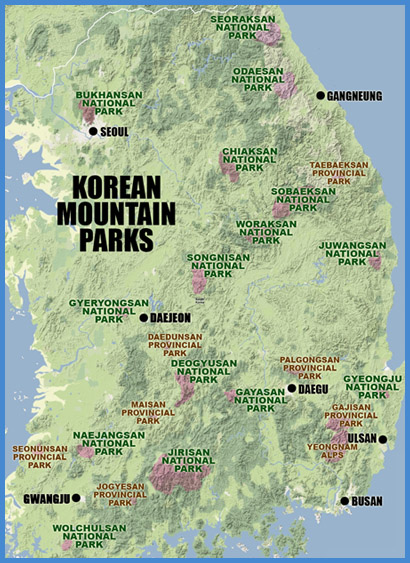
As an international hiking destination, South Korea has been a bit overlooked. This is mainly due to the lack of English information available to foreign hikers and climbers, but also a product of Korea's underdeveloped foreign tourist industry. Most of the national parks in Korea have simple English maps or brochures, but the practical information is limited and takes a backseat to the nation's rather tiresome habit of boasting and exaggerating about everything it has to offer. This turns a lot of Westerners off, which is unfortunate, because Korea does have much to offer the motivated hiker. It's an extremely rugged country overall, with small to medium-sized mountains covering 75% of the nation's land area.
Though small in area, the Korean national parks are diverse and beautiful. There are a total of 20 national parks in Korea (including 16 mountain parks), making up an impressive 3.7% of Korea's total land area. The mountain parks are scattered throughout the peninsula, with Seoraksan the farthest north and Wolchulsan the farthest south. Mountain ranges are often the basis of provincial boundaries, and consequently 7 of the 16 parks lie on the borderlines of the provinces and can be accessed from multiple directions. Jirisan, the largest and oldest of the national parks, is found at the nexus of three provinces--South Gyeongsang, South Jeolla, and North Jeolla--and offers the most serious hiking in the country.
Every park is unique, ranging from smooth, rolling hills and valleys to ragged, craggy ridges and sheer, rocky cliffs. Most the parks offer a wide variety of easy to moderate day hikes and a few longer, more strenuous routes. The longest and most strenuous route in Korea crosses the entire Jirisan range and takes about 3 days (we did it in 2 days, but it was pretty brutal). Camping facilities, though fairly undeveloped, are available at some parks, but most are only open during the peak summer season. Some of the large parks, such as Jirisan and Seoraksan, have mountain shelters where long-distance trekkers can crash. None of the parks in Korea allow backcountry camping, which is probably wise considering the number of local visitors these parks get. To further protect the natural geography, the Korean National Park Service (KNPS) temporarily closes trails on a rotating basis to allow wildlife to recover.
OFFICIAL KOREAN NATIONAL PARK WEBSITE (ENGLISH)
CURRENT TRAIL CLOSURES (ENGLISH)
As an American who has hiked extensively in Korea's national parks, I'm continually surprised by the number of foreign residents I meet who have never explored the park system. And yet, it's understandable, considering the lack of easily accessible, accurate, English language information. Before setting off into the hills, most people want to know what they're getting into, how to get there, how long it will take, how much it will cost, and where to stay. Random exploration is great if you have unlimited time and resources, but not if you only have 48 precious hours of weekend freedom before you start work again on Monday morning.
The purpose of this site is to provide people with the information they need to enjoy Korea's mountains fully. During the two years I lived in Korea, I gathered as much information as I could about hiking in the parks, and much of it is posted here. Now that I'm no longer living in Korea, I'm opening the site up to the rest of the hiking community. What we need here are detailed summaries of the different hiking and mountaineering options in Korea, along with detailed trail maps, transportation info linking the parks with major urban centers, photos, etc. You can help KOREA IN THE CLOUDS by saving all the maps and pamphlets you get when you visit the parks and by taking note of trail closures you encounter, changes in fees, the operating capacity of mountain shelters, and anything else that would be of interest to hikers. Then pass that on to me at alexzuccarelli@gmail.com so it can be added to the blog. Of great worth are verified hiking distances from point to point, as these are not shown on currently available maps (except those I've created).
I hope you all find this blog to be helpful and accurate. Please let me know, if there errors that need to be corrected. alexzuccarelli@gmail.com